Picture source: Panama7
Europe
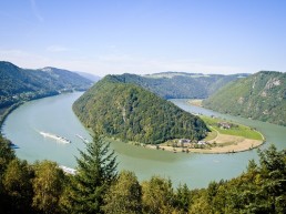
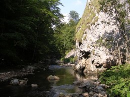
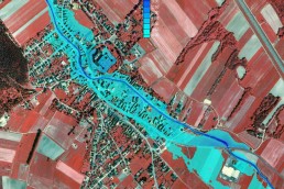
Hazard Risk Maps for the Province of Burgenland, Austria

Assignment location
Austria, Europe

Client/Funding
Government of Burgenland, Austria
Preparation of hazard risk maps for four rivers in line with RIWA-T (Technische Richtlinien für die Bundeswasserbauverwaltung) as well as relevant guidelines for hazard risk mapping:
- Measurement of the project area (airborne laser scan)
- Creation of a homogeneous digital terrain model
- Set-up of a 2D hydraulic model (SMS / Hydro_AS-2D)
- Calculation of relevant outflows HQ30, HQ100 and HQ300
- Elaboration of water levels, water depths, flow velocities, sole shear stresses
- Designation of risk zones
© Hydrophil GmbH